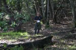
Morgan Territory Regional Preserve
Date: (Sun.) Mar. 1, 2020
Location: Livermore, CA
Event Director: - 650.404.7037
Course Setter: Yurii Konovalenko
Type: B; Standard 7-course event for beginners through advanced at one of our popular parks
Related Event Information
Course Setter’s Notes
By Yurii Konovalenko
We are excited to welcome you to this incredible place. The terrain in Morgan Territory Regional Preserve is diverse and includes open runnable forest—often with technically challenging boulder fields and small landform shapes—as well as open lands and forest with thickets.
In my opinion, this map is one of the most interesting and technically challenging in the Bay Area. I hope the courses are interesting and challenging as well. They are designed to be as fun as possible: avoiding areas of thickets and poison oak, while maximizing the pleasure of clean forest full of details, like boulders covered with moss.
Courses
Here are the preliminary course details (which might change slightly):
                                                Water    Map
    Course   Distance      Climb      Controls  Stops   Scale
    White     1.9 km     40 m (2.1%)      8       0    1:10,000
    Yellow    2.8 km     60 m (2.1%)      9       1    1:10,000
    Orange    4.3 km    140 m (3.3%)     12       2    1:10,000
    Brown     3.9 km    100 m (2.6%)     13       2    1:10,000
    Green     4.9 km    140 m (2.9%)     17       2    1:10,000
    Red       6.5 km    200 m (3.1%)     21       2    1:10,000
    Blue      8.3 km    275 m (3.3%)     26       2    1:10,000
Beginners should be aware that the distances shown are the cumulative straight-line distances between controls. Your actual distance will be somewhat longer. For a rough estimate of how far you will actually go, mentally change “km†to “mi†(e.g., for a “2.0 km†course, you might travel up to “2.0 miâ€). The climb numbers represent the amount of ascending that would be done on the “optimum route†(in the Course Setter’s opinion), without regard for any descending.
All the courses, except White, have 1–2 controls with drinking water, spaced about 2–3 km. All water controls are marked accordingly in the control descriptions.
Map
The map scale is 1:10,000 for all courses.
The contour interval is 5 m.
The quality of the map is very good. I updated it with a few new trails and some changes to vegetation. However, there are still some unmapped cow trails, which I did not add, since they tend to come and go. The contours and vegetation are generally accurate.
Special Symbols
× – Rootstock, fallen tree. This feature is used as a control location on the Intermediate (Orange) and Advanced (Brown–Blue) courses.
o – Lone tree. This feature is used for controls on the Green, Red, and Blue courses.
Most (mapped) boulders are shown according to ISOM 2017 (2MB PDF) standards:
- The smallest black dots show stony ground; the dots are randomly distributed and do not represent any specific feature.
- Midsize black dot = a distinct boulder (should be higher than 1 m).
- Large black dot = a large boulder more than 2 m high.
- Black triangle = a distinct group of boulders so closely clustered together that they cannot be marked individually.
- Black triangles of random shape = an area that is covered with so many scattered blocks of stone that they cannot be marked individually; the triangles are randomly placed and oriented, and do not represent any specific point feature.
Please refer to the ISOM standard, section 3.2, symbols 20–214 for additional information.
Note that, as usual, there are boulders that are not mapped, because they do not meet the minimum criteria for inclusion.
Start
The Start is located 0.3 km from the assembly area, with 15 m of climb. It takes about 5 minutes to walk to there.
Finish
The Finish is located 0.2 km from the assembly area, with 20 m of climb. Please follow the streamers to reach the assembly area.
Hazards
The park is full of boulders that can be slippery, especially when moving at high speed.
Shoes with spikes are strongly recommended for the Intermediate (Orange) and Advanced (Brown–Blue) courses.
The Red and Blue courses have fence crossing(s). Do not jump or climb over the fences. Roll under the wire—it is quick and safe (and can’t damage the fence).
Morgan Territory Regional Preserve does contain some poison oak. Most of it is small and low, with its shoots reaching up to knee or hip level, while several larger thickets are present across the park. The leaves are just about to appear, meaning that sometimes it is not as visible as usual. Be aware that even the bare stalks should be avoided. The courses are designed to avoid areas of poison oak.

